Issue 24
World
Sunflowers for all
‘Logic’ of Cities. Interesting visualization of city layouts using polar charts. The creator of Leaflet with a pretty cool visualization. See the interactive map for more:
- https://www.bloomberg.com/news/articles/2018-07-26/mapping-the-hidden-patterns-of-cities?accessToken=eyJhbGciOiJIUzI1NiIsInR5cCI6IkpXVCJ9.eyJzb3VyY2UiOiJTdWJzY3JpYmVyR2lmdGVkQXJ0aWNsZSIsImlhdCI6MTY5MjAxODMwNCwiZXhwIjoxNjkyNjIzMTA0LCJhcnRpY2xlSWQiOiJROVJVNFdEV1gyUFUwMSIsImJjb25uZWN0SWQiOiJDMjQyMDJGNjE2NzM0NUY1QTg0NEQxQTExRjE3MjNCMiJ9.Q7LWxmnmAvxGj47eYFz115dzpDd2Cw0TMIrZzwLn6OY
- Create them yourself with the Open Source Road Orientations Map: https://github.com/mourner/road-orientation-map
- How Vladimir did it: https://blog.mapbox.com/visualizing-street-orientations-on-an-interactive-map-1eefa6002afc
- Interactive map: https://mourner.github.io/road-orientation-map/#12/40.734/-73.992
- Here’s Bend’s polar chart: https://mourner.github.io/road-orientation-map/#9.97/43.9575/-121.264
Ecuador
Assasination. I don’t cover too much contemporary geo-political neww, but this was pretty shocking. Ecuador has major cartel problems and that seems to have happened very quickly.
Germany
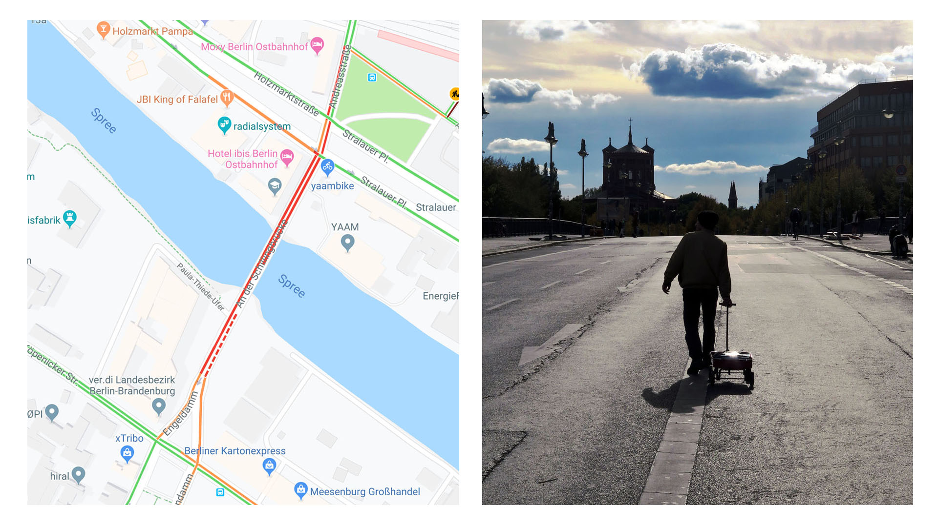
German artist hacks Google Maps with a fake traffic jam using 99 phones in a little red wagon.

South China Sea conflict
US
United States, Northwest
Oregon Howl. An interesting site with a few interesting maps:
- https://oregonhowl.org/
- Logging in Oregon - Mapping clearcuts. This makes the strip mining of Northwest forests clear: https://logging.oregonhowl.org/
- Visualizing Wolf OR-7 (with Cesium). You can hit “play”: https://oregonhowl.org/?view=or7